THIS ARTICLE: Offers a basic overview of how you might go about climbing Mount Everest. It introduces some key terms, highlights the likely difficulties and explains the two main routes to the summit as well as touching on the alternatives. It also covers the basic costs.
[divide]
[box type=”note” bg=”#ebebeb” color=”#111″ font=”arial” fontsize=”13″ border=”#a6a6a6″ head=”Get the Book” headbg=”#21417b” headcolor=”#fff”]
 This is an early test article for my book – How to Get to the North Pole: and Other Iconic Adventures – which includes a chapter on How to Climb an Unclimbed Mountain and six other classic expeditions.
The book features a foreword by Sir Ranulph Fiennes, endorsement by Bear Grylls and contributions from over 50 other explorers. It is a Top 10 best-seller on Amazon’s ‘Discovery & Exploration’ section with a user rating of five-stars.
[button color=”green” link=”http://thenextchallenge.org/books” size=”big” font=”arial” fontw=”bold” textcolor=”#fff” texthcolor=”#d00000″ align=”center” radius=”10″]Read More[/button]
[/box]
[divide]
Mount Everest
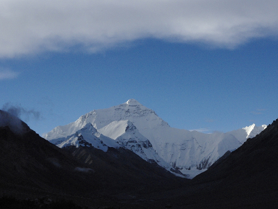
We all know about Mount Everest. At 8,842 metres (29,029 feet) it is the heighest mountain in the world. First climbed by Edmund Hillary and Tenzing Norgay in 1953 and the stuff of dreams for so many mountaineers and armchair adventurers.
It’s located in the Himalayas, straddling the Nepal-Tibet border and over the last decade or two, its summit has been brought a little closer to earth by the proliferation of commercial expeditions offering trips there. But it is still possible to climb it through your own planning and it is still a tough expedition whichever way you tackle it.
There are plenty of websites and articles offering in-depth route descriptions, current weather conditions and the latest prices with which it would be futile for me to compete. Instead, I’m offering here a basic overview for those new to the area and considering having a go, or simply interested in what’s involved.
We’ll start that process with a few explanations…
Key Terms
Some of these terms may not be referenced directly in this article but you’ll want to know them if you plan to get anywhere near 8,000 metres.
- The Death Zone – Term given to altitudes above 8,000m where it’s not possible for your body to fully adapt to the rarefied air and it therefore rapidly deteriorates
- Acute Mountain Sickness (AMS) – The collection of symptoms that can result from exposure to the decreased oxygen at high altitudes.
- Fixed ropes – These are ropes that have been secured in advance on steep or difficulty sections of the route for climbers to pull themselves up with and use as security.
- Jumar – A piece of climbing equipment that you hold in your hand and attach to fixed ropes. It will move in one direction and not the other allowing you to use it as a handle and drag yourself up a rope.
- Khumbu Ice Falls, Hillary Step, South Col etc – So well trodden and reported is the route to Everest’s summit that every landmark along the way has been given a name. I’ve explained any of the significant ones below in the body of the text but for any others you come across, you can bet that there’s a Wikipedia article that will explain it all to you.
For more information about AMS and acclimatisation, you can read a free excerpt from my book here: Advice for Climbing at Altitude.
[divide]
Difficulties Faced
Altitude (Mountain Sickness)
This is the big one and it will affect many aspects of your health on the trip. The higher you get, the less oxygen there is in the air. Your body can slowly adapt to this but only up to a point. Even with the comparatively lengthy period required to climb this high, you are unlikely to ever feel quite yourself above base camp, and in the Death Zone above 8,000m you are beyond the limit of your bodies adaptation ability.
What this means in real terms is that any exertion will feel considerably harder than it would at sea level. You can develop persistent headaches and lose your appetite, and cuts won’t heal properly. Additionally, on the higher slopes, your ability to think clearly will likely be impaired – anything from an inability to complete basic arithmetic to complete loss of rational thought.
These many not seem like great issues but, aside from my reassurance that they will be, bear in mind that they will all be happening to you whilst you are trying to climb the highest mountain in the world.
More serious side effects can occur from AMS. Specifically, Pulmonary and Cerebral Edemas which are fluid in the lungs and a swelling of the brain respectively. Both of these can be fatal and the best treatment, if not the only one, is descent.
Temperature
Air temperature drops by roughly 0.65C per 100 metres of height gained. That means at 8,800m you can expect the temperature to be about 57C less than at sea level. That’s a gross simplification ignoring many other factors but you get the idea: it is cold up there. Managing this is not helped by the fact that you’ll switch from lying still in the darkness at night to slogging up hill with the heat of the sun bearing down from above and reflecting up from the snow.
Weather
In the UK it may be a compulsive topic of mundane conversation but in the Himalayas it can mean life or death. Your window of opportunity for summiting will be dictated by a good weather forecast but many are the climbers who have been caught out by storms, holding out a little too long on summit day. Not least during the 1996 disaster. You can’t control the weather gods but you can get good forecast, listen to your instincts and not ignore the early warning signs.
Falls
One of the highest direct causes of death on Everest is falls. These can happen both when actually climbing, particularly on the high ridges, and also in careless moments at the higher camps. Stepping out of your tent for a wee at night onto ground covered in ice being a particular example. Maintaining vigilance with your footwork, double checking knots and karabiners, and a good amount of prior experience on snow and ice are prudent steps for reducing this risk.
Avalanche
Twice as likely as falls to get you on the slopes of Qomolangma (Tibetan name for Everest ) are avalanches. There tend to be specific areas in which the likelihood of their occurrence is higher. On the two most popular routes (see below) these are the North Col, South Col and Khumbu Ice Falls (the latter being branded “Suicide Passage” for this reason). They’re all necessary to cross and there’s not a lot you can do to control the mountain itself but you can help by minimising your time in those areas and using the earlier parts of the day before the sun has warmed the snow.
In addition to falling snow, falling ice and rocks are yet more hazards you can face. This is particularly the case if you choose the Southeast route from Nepal. There, the former is a risk in the Khumbu Ice Falls (there’s a hint in the name) and the latter when crossing the South Col beneath the Lhotse Face.
Crevasses
These are great cracks that appear in glacial ice which threaten to swallow careless or unfortunate climbers. If you climb from the Nepali side then you will encounter these in the Khumbu Ice Falls and the Western Cwm. To aid safe travel across glaciers, teams tie ropes between each of their members so they can drag out anyone unlucky enough to take a fall.
Summit Fever
Easily said but near impossible to avoid entirely, the temptation to push on for “just another ten minutes” is strong in all of us. But combine it with the intoxicating zenith of so much effort and the mind-altering effects of altitude on the danger-ridden slopes of Mount Everest and you have a recipe for disaster.
The practical advice is to have a set “turn around time” at which point you head back down regardless of where you are, is a common tactic to avoid this. Just be realistic when deciding it. There’s no point setting an overly conservative time if you know you’re not going to stick to it.
Something else worth doing is taking the time to go through your motivations for being on the mountain. If you keep the summit in perspective with the rest of the challenge and the rest of your life then it may help stop you from getting carried away.
More detail on the risks of climbing remote mountains and how to deal with them can be found in my book: How to Get to the North Pole (and Other Iconic Adventures).
Fatalities
It makes for grim reading but here is an article compiling Mount Everest Death Statistics from 1922-2019.
[divide]
When To Climb
It is the weather which determines suitable periods for summiting. Spring is the most settled and May in particular has by far the most successful summits of any month. The season can stretch on as late as September, however, and the mountain has also seen a few winter ascents as early as February.
Route Choices
There are about fifteen recognised routes up Everest to date. However, there are really just two popular routes which have each seen more ascents than all of the other options combined. For that reason, I’ll give most attention to describing the standard Southeast and Northeast Ridge routes from Nepal and Tibet respectively.
(N.B. There are plenty of different small variations possible in these routes so the following descriptions, and the heights given in particular, are just a rough guide)
Southeast Ridge (South Col) Route from Nepal
This was the route used to first gain the summit in 1953. With over 1000 successful summits to its name, it is by far the most frequent and contains many iconic landmarks such as the Hillary Step and Khumbu Ice Falls. It is the base camp on this route that is most often referred to when people talk about “Everest Base Camp”.
It is probably the easiest option (relative term) though is sometimes considered a little more dangerous than the Northeast Ridge for its many objective obstacles despite having a lower fatality percentage.
Your likely route will be to fly from Kathmandu to Lukla (2,860m) and spend somewhere in the region of a week walking to a base camp at around 5,300m. From there onwards you usually have four camps on your way to the top:
- The first is reached by passing through the legendary jumble of ice blocks and crevasses in the Khumbu Icefalls with ropes and ladders to just over 6,000m
- From there you head up the Western Cwm to Camp II (~6,500m) at the base of the Lhotse Face. This section is comparatively sheltered and makes for sweltering conditions in the sunlight.
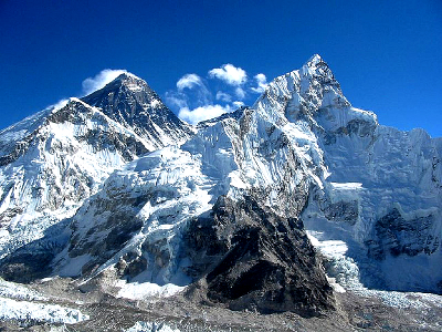
- Lhotse is the closest peak to Everest and its western flank is known as the Lhotse Face. You’ll climb this relatively steep section using fixed ropes to Camp III close to 7,500m.
- It’s only another 500m up from here to Camp IV but requires getting over the bulge of the Geneva Spur and traversing the Yellow Band of rock. The next leg is the summit push.
- You’ll first reach The Balcony at 8,400m, a small ledge famous for its views. You cross the small mound of the South Summit (8,750m) and follow a narrow ridge to the large rock wall known as Hillary Step. From the top of the step, it’s a gradual snow slope to the top of the world.
Northeast Ridge Route from Tibet
Mallory and Irvine used this route for their fatal 1924 attempt but don’t let that put you off. Since then more than 600 people have reached the summit in their footsteps. It has a few hurdles that make it a little trickier than the Southeast Ridge but less of the scary bits.
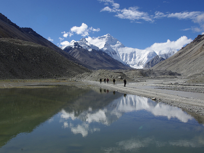
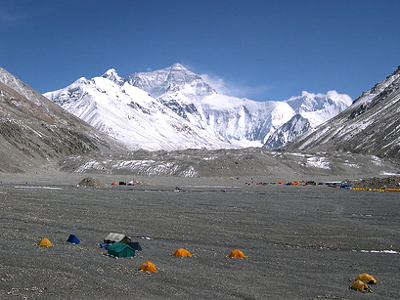
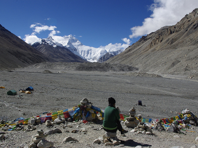
To reach Tibet you often still go via Kathmandu then take a bus or plane across the border. Base camp on the north side is by the Rongbuk Glacier at around 5,200m and you have the luxury of being able to drive there although this shouldn’t be taken as an excuse to not acclimatise properly. From here you’ll likely have three or four camps on your way to top:
- First up is a long hike along the glacial morraine (rocks) to Advance Base Camp (ABC) at 6,400m with one or two intermediate camps on the way.
- Then you press on up steeper ground to Camp I (7,000m) on the North Col until taking a left turn for a further 500m up the north ridge to Camp II (7,500m).
- You progress over rock once more to Camp III (sometimes skipped) on small ledges at around 7,900m which you follow towards Camp IV until reaching the snow of the north face. You’re now at close to 8,300m and ready for the summit attempt along the Northeast Ridge itself.
- The ridge comprises three large “steps” which require a bit of scrambling made trickier at such height though aided by the placement of the semi-permanent “Chinese Ladder” (literally a ladder) and a fixed rope on the more difficult second step. After this there’s a snow slope and the final ridge to 8,848m.
Other Options
If you are joining a commercial expedition or your focus is simply to get to the top, then one of the above routes is likely the choice for you. But there are many other options if you’re looking for something more adventurous. There is a good list of the different routes and their relative dangers here.
Costs
Your costs for climbing Everest are, broadly speaking, kit, flights, permits, supplies (e.g. food, fuel, oxygen), Sherpa support and guides. Some of these are optional (e.g. guides and oxygen) and the amount you spend on others (e.g. equipment, Sherpas, food) may directly effect your chances of summiting.
There are myriad options for all of the above, many articles and companies giving details, and the prices are ever fluctuating. Rather than trying to give a list of specific prices that would be subject to debate and rapidly become out-dated, I will just give you a brief overview:
To join a commercial expedition, a package including almost everything except your personal kit will probably cost between about US$35,000 and $75,000 depending on the company for the Southeast Ridge route and more like $25,000-$35,000 and upwards from the less frequented Tibet side.
If you’d prefer to do it on your own then you can expect the price to be in a similar ball park. Some costs are fixed, like hefty climbing permits (upwards of $10,000), others you might able to reduce by micro-managing (e.g. food or Sherpas), and others still will end up costing more because you don’t have the economies of scale on your side.
Whichever way you’re doing it, unless you already have experience climbing high mountains then you should expect to fork out more money for training trips at altitude.
(There’s a simple breakdown at What It Costs and Alan Arnette provides a very helpful table comparing costs from all the top companies)
For details of the necessary climbing, camping and cold weather equipment and kit for climbing high mountains, try my book: How to Get to the North Pole (and Other Iconic Adventures)
[divide]
What Next?
You can talk the lingo, you’ve read up on the dangers, know what the route choices are and have an understanding of what it costs. There are decisions to make, funds to be found and altitude experience to obtain, but then it is time to head for the mother of all view points. Good luck!
(Thanks to Karolina Raczynska, Andrew Purdam and Alex Anderson for the photos)
If you enjoyed this short ‘How To’ expedition guide, why not get a copy of ‘How to Get to the North Pole: and Other Iconic Adventures‘ which goes into much more detail about a whole range of challenges. Read more…
[divide]
How to Get to the North Pole:
and Other Iconic Adventures
Newly published for April 2012
6 more chapters. 10 times the detail.
[button color=”green” link=”http://www.thenextchallenge.org/books/” size=”big” target=”_blank” font=”arial” fontw=”bold” textcolor=”#fff” align=”center” radius=”10″]Order Now[/button]
[divide]
What do you think? Please do add your thoughts below…